It should have been a simple Sunday afternoon bicycle outing yesterday in (finally) beautiful weather. We decided we would like to ride to the nearby town of La Truchère on the banks of the Seille River. The Seille is a tributary of the Saône, and a cruising destination in its own right, so a foretaste of possible things to come seemed like a fine idea. Our Google Map directions gave us 3 options:
 |
| 3 choices of route from Pont de Vaux to La Trouchére |
 |
| Lon biking on what--apparently--counts for a road in rural France on Google Maps |
 |
| Curious Charolais cows, who galloped over to check us out after we encroached on their pasture while in search of a way forward to La Truchére. Cute, but rather muscular, so I took this photo from the other side of the fence. |
The previous Sunday's outing was more predictable and sedate. We followed the well-marked and well-maintained "Voie Bleue" (Blue Route) cycle route for about 10 miles along the Saône river to Tournus, a town of about 6,000 people. Tournus became an important religious center in the 9th century.
 |
| Lon just above the boat quay in Tournus. |
 |
| The tower of the Romanesque Abbey St. Philibert, from the 11th and 12th centuries. |
 |
| The Eglise Saint-Valerien, which served as Tournus' abbey from 1008-1028. |
 |
| Lon at our relaxing lunch in Tournus. We were lucky to find a place to eat--May 26 was Mother's Day in France and many of the restaurants were fully booked. |
Otherwise our week was primarily spent working on projects, interspersed with some relaxation and social activity. While Lon was working one afternoon I cycled the Pont de Vaux canal towpath to the nearby village of Fleurville, which is about 3 miles directly west of us (just across the Saone). These days Fleurville is a fairly non-descript small village; nevertheless, it boasts two (2) chateau (castles) from the old days. Talk about tripping over history in the most unlikely of places; however, it is not an uncommon occurrence for small villages in the area to have a really amazing old church or chateau.
 |
| Side view of the round tower and main building of the Château de Fleurville. It was built by the Counts of Fleur Ville in 1624 and is now a hotel |
 |
| The Château de Marigny. Construction begun in the 13th C, finished in the 16th C., pillaged during the French Revolution, later renovations and expansions. Currently privately owned. |
 |
| Springtime in France means poppies. |
 |
| We are visited fairly often by this young man from a neighboring boat. Besides being very cute, a big plus is that he seems to understand our English about as well as he understands French. |
 |
| Docktails on Sunday (June 2) with South African boaters Elaine and Tony Underwood. Elaine and Tony have been cruising French inland waterways for 15 summers. |
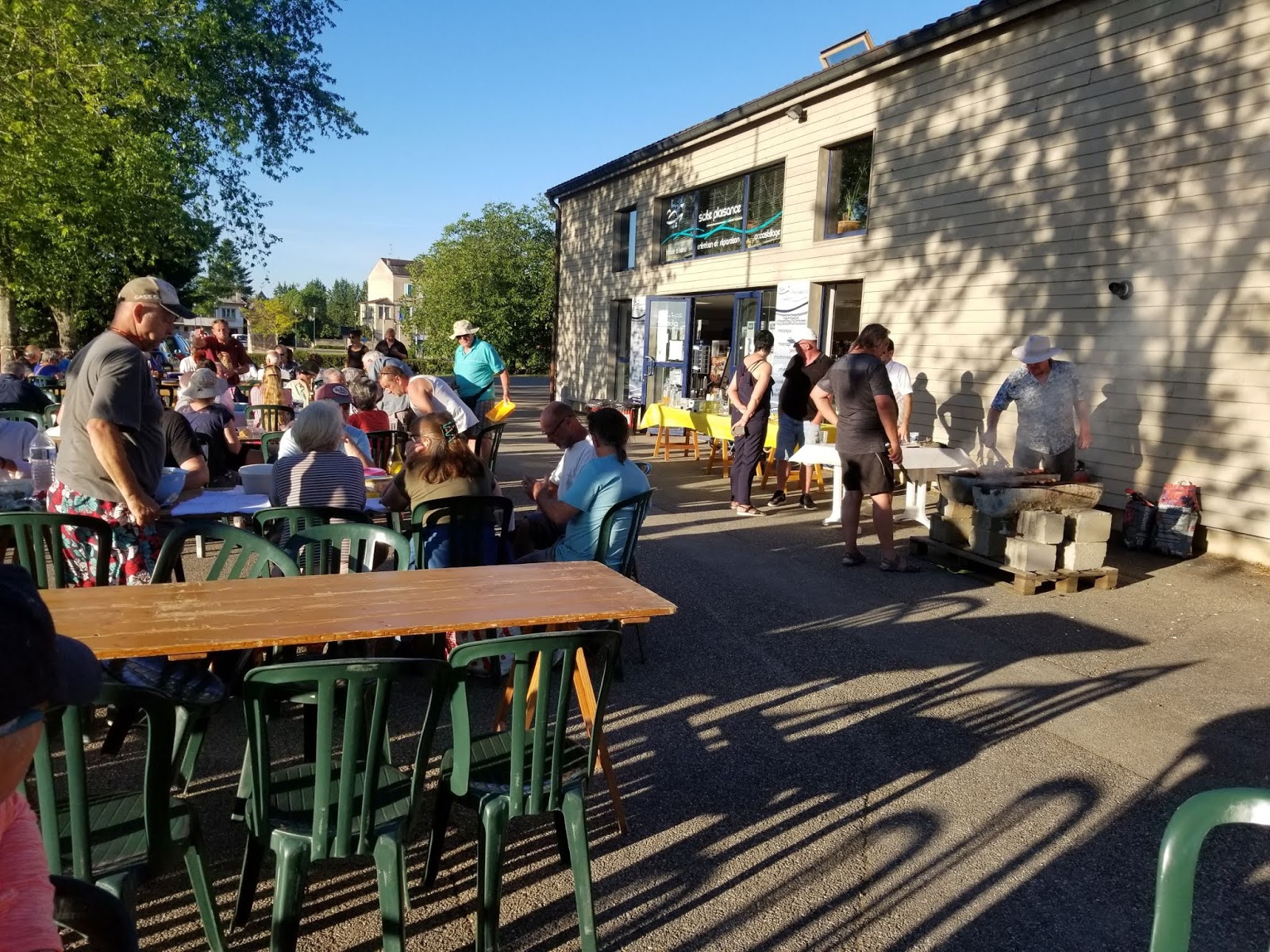 |
| The Port de Plaisance (pleasure port i.e., marina) hosted a party for their customers on Saturday (June 1). Four of us were native English speakers, everyone else spoke French. A few attempts were made to bridge the language barrier, so all was congenial. |
We've changed our tentative cruising plans. Rather than heading south and doing mostly river cruising this summer, we've decided we would rather head north and seek out more of a canal experience. That's today's "plan" anyway, always subject to change!
This comment has been removed by the author.
ReplyDeleteI can empathise with your experience with Google Maps and cycling. Several times we’ve ended up on rocky farm paths or goat tracks through brambles and nettles. They must source their routes from adventure biking groups. We’re wary, these days, of any countryside route Google offers that’s not a road or clearly marked bike trail.
ReplyDelete